Answers to frequently asked questions
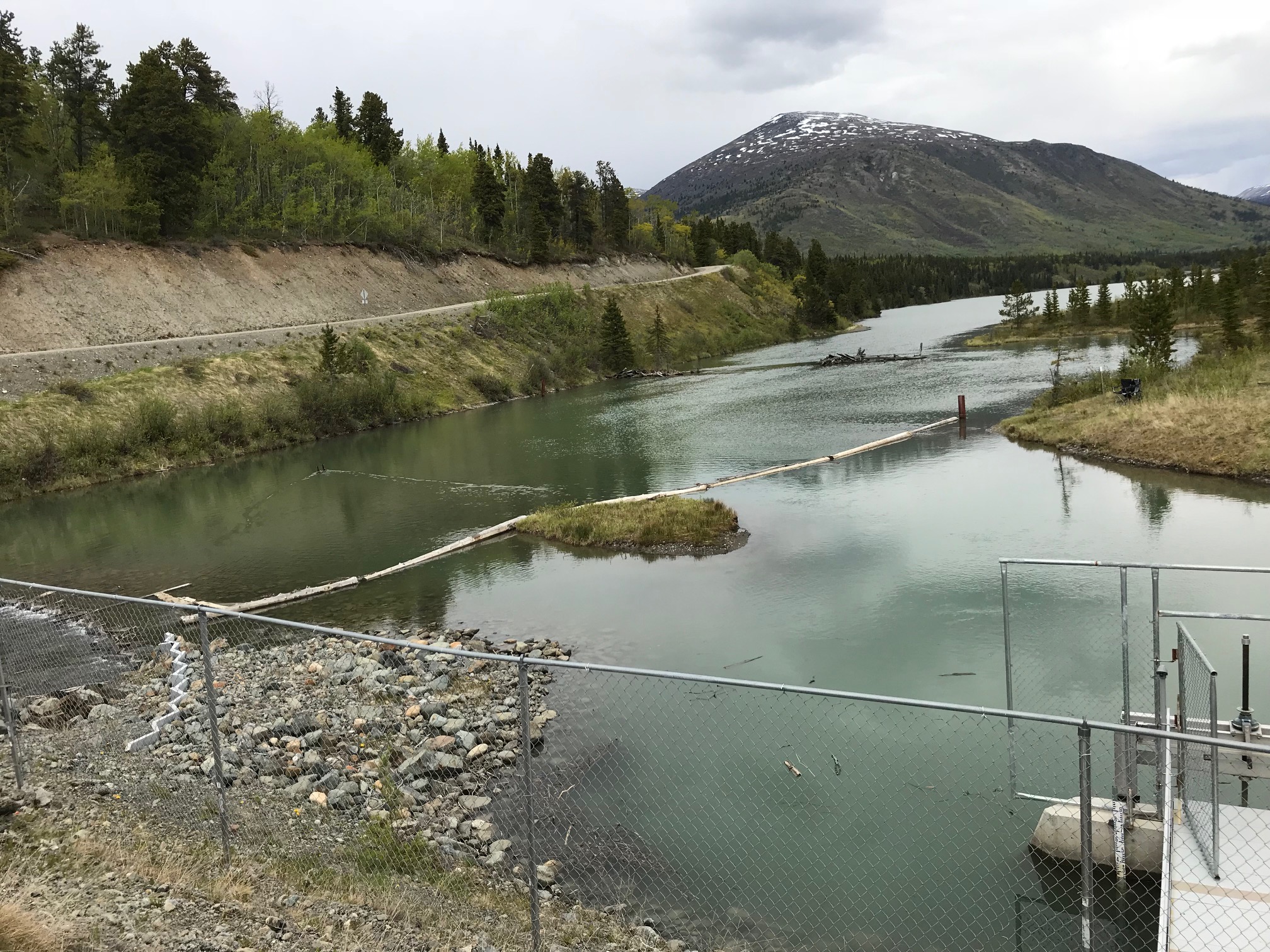
Is it true you are taking 90% of the water in Pine Creek?
No! THEL is not using 90% of the water in Pine Creek.
The minimum flows proposed in lower Pine Creek at any given time is 10% of the Mean Annual Discharge (MAD), where MAD is the available discharge from Surprise Lake averaged over the whole year. The AHEP proposal ensures that the lower reaches of Pine Creek have flows of at least 10% of the MAD throughout the year, but that does not equate to using 90% of the water to generate power. Water used to generate power will depend on energy demands and availability of water stored in Surprise Lake, but flows in the lower reaches of Pine Creek will always be at least 10% of the MAD.
For reference, winter flows in Pine Creek prior to the construction of the existing hydro facility were approximately 10% of the MAD.
Will groundwater be affected? (wells and alkali flats)
The alkali deposits are associated with deep, regional groundwater flows. Because Pine Creek is largely a groundwater discharge site (not groundwater recharge), change in flow will have no impact to those deposits and/or groundwater flows to them. In other words, Pine Creek is not “recharging” the groundwater system and won’t reduce the groundwater flux to those areas. None the less, even with reduction in flow, it does not change the wetted area of the creek by much, and thus the surface water/groundwater interaction does not change much.
What will happen to the beaches on Surprise Lake?
The beach formation process will continue, so Surprise Lake will continue to have spectacular beach formations like those at Pine Cup Creek and Hemlock Creek. Beaches will continue to grow through erosion and deposition. After a couple of high water- high wind events, beaches will become more prominent, being raised up and pushed inland slightly. While the first couple of seasons may see greater inundation, beaches will recover their recognizable features in both the short and long-term timeframes. Access and existing camping areas will be unaffected, with the exception of some areas along the Pine Cup Creek spit, which will shrink in the near-term under highwater conditions.
What will happen to nesting shorebirds?
In terms of inundation, the impact to shorebirds is expected to be neutral, since high water will occur later in the season, and shorebirds are adapted to annual fluctuations in water levels.
Habitat loss for wetland nesters may occur at Boulder Creek; however, new wetland habitat may also be created. Although these changes may be locally important on Surprise Lake, these potential impacts are not considered significant from a population or regional perspective.
Monitoring of habitat changes will occur.
Has an environmental review been done?
Yes. We have developed a Clean Energy Development Plan (CEDP) and it has been submitted to the Province of BC and the TRTFN. These parties are currently completing their review. A copy of the CEDP can be found at Clean Energy Development Plan.
Who is the expansion project being built for?
The project is being built to supply power to the Yukon, with the proceed going back to the community of Atlin.
Who owns the power generated by the expansion project?
THEL will own all the power generated by the Atlin Hydro Expansion Project, and all of the profits go back into the Atlin community. THEL will negotiate an Energy Purchase Agreement with Yukon Energy Corporation for the sale of the power.
How does the expansion affect the power needs of Atlin?
The Atlin Hydro Expansion Project will only generate power for the Yukon once the power needs of Atlin have been met. The power needs of Atlin are the first priority when it comes to the water resources of Surprise Lake.
Can the transmission line along Atlin Road be buried to minimize the project's visual impact?
We have looked into burying the transmission lines along Atlin road and the cost estimates are 10 – 14 time that of going with overhead transmission lines, which are typical for this sort of project.
What will happen to Stone Sheep movement at Pine Cup Creek?
Sheep don’t actually migrate but, if required, rams will move during the rut (fall) to find females. Since high water levels occur later in the summer, movement is most likely to be affected from August until ice-up. Impacts would be possible if males were moving across Pine Cup Creek to find females and preferred to use the spit. However, animals can still cross further up the valley.
Wildlife game cameras are being used to monitor sheep movement to assess potential impacts; to date, no sheep have been observed crossing the valley and/or using the spit.
Other movements, natural dispersion events, take place in early spring and summer when water levels are not so high so impact is expected to be minor and animals can also still cross further up the valley.
How will the Project affect moose calving at Pine Creek Flats?
Although moose may calve in the area, it is not likely a key area for successful calving and survival of moose.
The Pine Creek outlet area offers high quality forage, which is not limited throughout the regional area, but a higher risk of predation due to proximity to the lakeshore and riparian area. This increased risk may be offset somewhat by proximity to the townsite, which may decrease presence of bears and wolves, but would increase the risk from domestic dogs. Over time, as dense early seral vegetation is replaced by mature forest, predator avoidance could increase due to better sightability. However, most moose likely calve on islands, peninsulas and higher elevations that are isolated from predator movement corridors.
What happened to the Use, Recreation and Enjoyment of the Public land use designation at Pine Creek Flats?
THEL was not aware that the designation was removed prior to submitting our Clean Energy Development Plan. We did not view the lower powerhouse as being in conflict with the designation, and our submission focused on how we could enhance recreation and use of the area. THEL was advised by the Province AFTER our submission that the UREP designation had been removed. Since the UREP designation was also consistent with the Atlin Land Use Plan designation of Pine Creek Flats as High Value Community Use area, we did not change our assessment, but considered the values to still exist. The Province advised THEL that the designation had been removed one-year prior, in addition to over a thousand other UREPs in the Skeena region.
What will happen to nesting Arctic terns on Surprise Lake?
Arctic terns nest sporadically on Surprise Lake, and are referred to as an intermittent colony. Terns are well-adapted to fluctuations in water levels, and the range from low to high water will be similar to other large water bodies in the Southern Lakes region, including Atlin Lake. Further, high water is expected to occur later in the summer, after the young have fledged (i.e. left the nest). As such, adverse impacts to nesting Arctic terns are not expected.
Will grayling spawning habitat be destroyed?
No. Based on years of field studies and the experience and professional expertise of Registered Professional Biologists, the grayling population in both Pine Creek and Surprise Lake will not experience significant adverse effects. Rather, impacts are expected to be neutral or positive on Surprise Lake. Monitoring of effects of the existing hydro project found that the grayling population in Surprise Lake and Upper Pine Creek has increased from pre-construction conditions to post-construction conditions. The grayling population relies on upper Pine Creek, generally above Birch Bridge, for habitat, with Spring Creek being the only location where spawning grayling were observed. Fish habitat will be maintained and restored in Upper Pine Creek, and the flows will support continued use by grayling throughout their life stages. Grayling use in the middle reaches of Pine Creek is considered incidental, such as grayling getting swept downstream, as several falls and hydraulic barriers, (places where water flows are high and turbulent), prevent fish passage up Pine Creek from Atlin Lake, with the lowest falls being located just above the Warm Bay Road Bridge. While grayling may be found in lower Pine Creek, no spawning habitat, spawning fish, or evidence of spawning, has been identified in lower Pine Creek. (For more details, please refer to the Existing Conditions report in Appendix 13 of the Clean Energy Development Plan on our website.) In terms of Surprise Lake, the proposed increase in the water level of Surprise Lake by approximately 40 cm occurs later in the summer when spawning is complete, and investigation of the creek mouths did not identify any barriers to fish passage that would occur at lower water levels in spring. Indeed, the AHEP will involve lowering the water levels to much the same levels as existed prior to construction of the existing hydro facility during the spawning season.
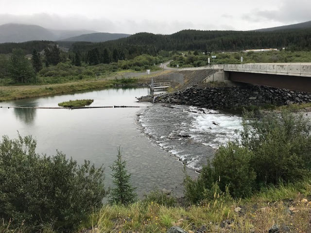
How will low flows affect the Pine Creek delta/flats?
The biggest impact to Pine Creek is anticipated in the lower bypass reach, but no major change to wildlife and habitat is expected.
The delta was formed during periods of placer mining (significant amounts of sediment in streams) and high peak creek flows. In its current state, the creek experiences significant avulsion, erosion and sedimentation, even in winter.
The Atlin Hydro Expansion Project will reduce peak and average flows and allow for a recovery from historic placer mining. Over time, it will shift to a smaller and more meandering creek in the lower reach, and there will be long-term stabilizing effects on the geomorphology and recovery of the creek for terrestrial riparian and aquatic species. These changes will also result in changes to wildlife habitat characteristics.
Will the lower powerhouse be noisy?
The lower powerhouse will be designed to be as quiet as possible. This means using quieter turbines and adding sound dampening materials to minimize and control the sound that can be heard at sensitive sites such as nearby residences, Pine Creek Beach, and Monarch Mountain Trail. THEL has engaged acoustic engineers to assess how sound travels, potential noise levels and disturbance, and will use the information to ensure that the final lower powerhouse design is not noisy.
What exactly will be done to control lower powerhouse noise?
THEL has engaged acoustic engineers to measure current sound levels at sensitive locations around where the lower powerhouse will go and that information, along with detailed mapping and geotechnical data, will be used by our hydro engineer to design a powerhouse whose sound profile has minimal impact at those sensitive locations. Some proven noise/vibration mitigation strategies include:
- Turbine selection: Francis turbines are known to be quieter than Pelton turbines
- Use of sound dampening materials: curtains of pliable material can be positioned to absorb/contain sound energy within the building
- Use of vibration dampening materials: springs and neoprene “snubbers” can be installed between equipment and building foundations to limit transmission of low-frequency vibrations outside the building
- Strategic placement of intake and exhaust outlets: directing building exhaust away from sensitive sites reduces the perception of noise at those sites
How will Pine Creek Trail be affected?
Overall the Project will increase accessibility on this trail, especially over Spruce Creek which will be passable year-round once the Project is done.
The Project’s lower penstock right of way mostly avoids the Pine Creek Trail except for a 150 meter section and a couple of potential pinch points; alternative routing can be developed for these areas if desired.
How will recreation at Pine Creek beach and in the flats be affected?
The main impact at Pine Creek beach is the development of the tailrace, which will affect beach users during construction and as a new, permanent structure. The tailrace’s dike will also provide accessible recreation and enjoyment of the beach by way of an approximately 500 meter long gravel path.
Access along the beach will not be impeded. In fact, THEL has proposed to work with the public to design and develop new and existing trails into a trail network that connects the beach with the campground and areas on the north side of Pine Creek. Our research suggests that a 5-6 km long loop trail that could also be used by skiers in the winter is possible, and we feel that construction of the lower powerhouse is an opportunity to enhance recreational use in this area for a broader user group, particularly for different levels of mobility.
Will my well be affected by lower flows in Pine Creek?
No: Pine Creek is a regional discharge creek, meaning water flows into Pine Creek not out of it, so groundwater wells will not be affected by reduced flows.
Will placer miner’s water use be affected/constrained by the project?
Water used for placer mining is returned to the creek so its use is usually considered neutral in terms of creek flow. Water used for placer mining is also comparatively minor relative to overall flow, but considerations could be required for future operations, depending on their size and geographic extent, to ensure that the points of diversion and water returns do not affect flow availability at hydropower diversion structures.
Why can’t you eliminate the lower powerhouse from the project?
The 2.8 MW plant is 1/3 of the proposed energy – that is significant! We’re in a climate crisis – every little bit helps! The cost of the transmission line and substations are the same no matter what the total energy generated for the Yukon is, and warrants maximizing the energy produced.
How much area on Surprise Lake will be inundated at high-water?
Approximately 32 hectares will be inundated at high water. This is about half of the average size of a cut-block in BC.
How much will water levels rise on Surprise Lake and at what time of year?
The proposed average high water level will be approximately 40 cm higher than the current average high water. The timing of when high water will be reached may vary, but typically will not occur until September – October.
Since the lake will also be drawn down to a lower water level than the current low water, high water is expected to occur later in the season than it does now.
For example, an existing high water level of 914.5 m asl is currently reached by about the second or third week of June, but this same water level would not be reached until after the first week of July under the proposed project.
Is the AHEP consistent with the Atlin Taku Land Use Plan?
It is THEL’s view that the proposed project meets the spirit and intent of the ATLUP, and THEL did not identify any examples of the AHEP contradicting the management direction for various zones and land use designations identified in the Plan. However, it is ultimately the role of governments to determine whether proposed projects conform to the management direction outlined within a land use plan.
Will the penstocks cross private properties and/or go through a subdivision?
No! Neither penstocks will cross private properties or go through a subdivision.
- The lower penstock will abut one private property off of South Pine Drive.
- The upper penstock will otherwise circumvent the properties in this location.