What will happen to flows on Pine Creek?
In a natural system in our climate, creek flows are generally highest during the spring and summer months due to melting snow. The flows diminish in the fall, reaching their lowest flows during the winter freeze-up. Prior to construction of the existing project, the minimum seasonal flows in winter on Pine Creek were about 0.5 m3/sec, while spring and summer seasonal flows averaged ~5 m3/sec.
However, in a regulated system, flows are reversed — lower in summer and higher in winter. This happens because water is held back in a reservoir during the summer months to allow it to fill (in this case at Surprise Lake), then released in the winter to feed a powerhouse.
Flows on Pine Creek are currently higher in winter than they were before the development of the existing hydropower facility (with a January monthly peak averaging ~1.5 m3/s, and a July monthly peak averaging 6.0 m3/s), but they are still highest in summer. With the development of the proposed Project, more water would be held back for longer in the summer months, and more water would be released in the winter months to feed the two new powerhouses.
The flows of different sections, or “reaches,” of the creek are affected differently. If you imagine Pine Creek as a cucumber and cut it in three places, you will end up with four pieces of cucumber. (Each cut represents a point where water is diverted from the creek. For more detailed information, visit the page “Water Levels and Flows,” or download the AHEP Information Guide.) The four reaches are known as Upper Pine Creek Reach, Upper Bypass Reach, Middle Bypass Reach and Lower Bypass Reach.
What will Pine Creek and Pine Creek Falls look like with these flows?
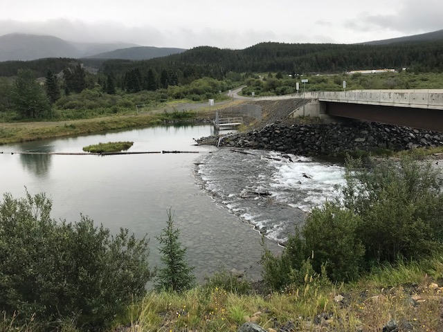
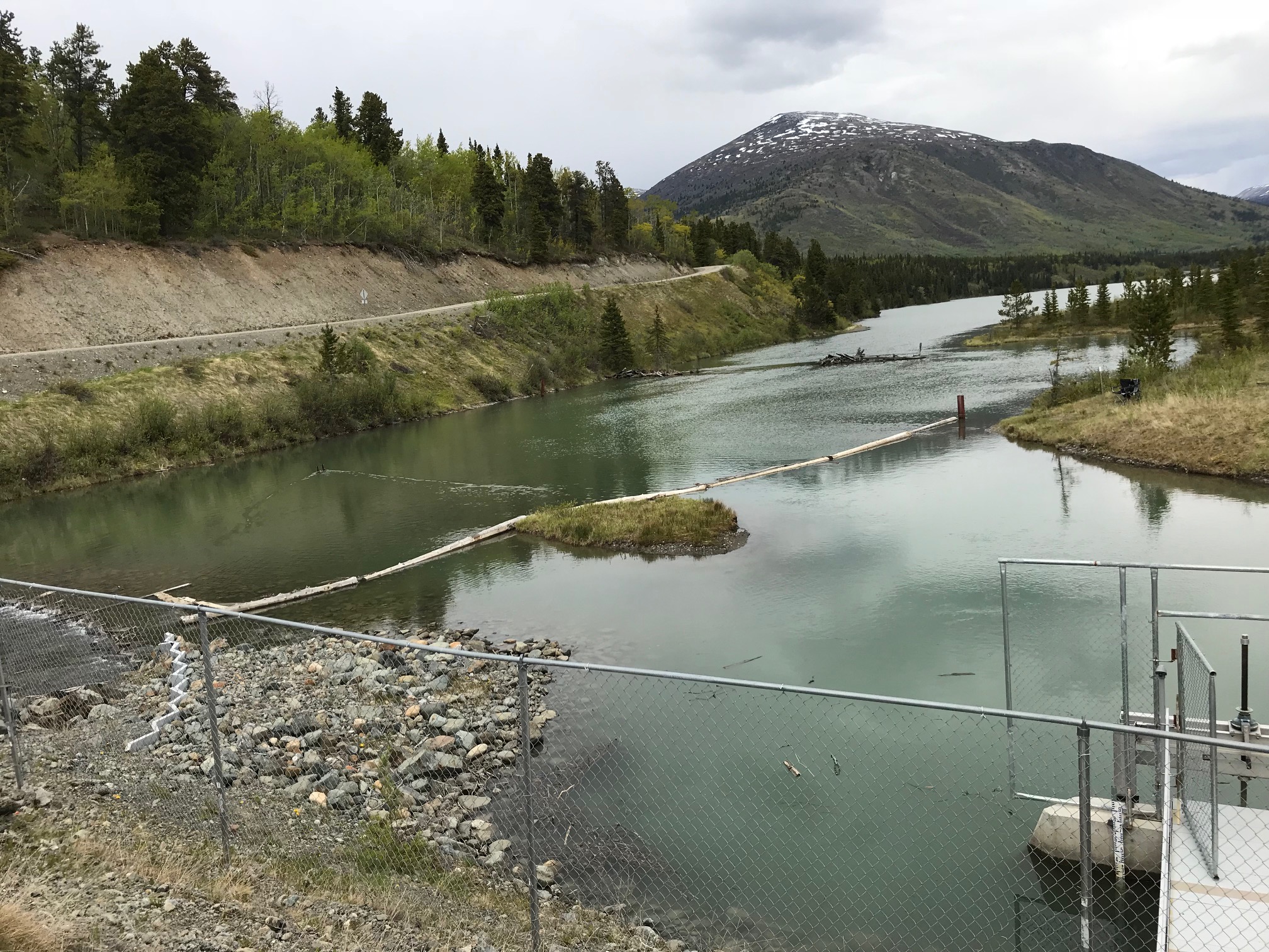
Pine Creek is visible from multiple viewpoints along Surprise Lake Road, various recreational sites (e.g. Powerhouse), trails, and the Warm Bay Road Bridge. Most of the recreational use along Pine Creek occurs in the Lower Bypass Reach, where flows will range from 0.5 – 0.8 m3/s, which is 20% – 50% lower than existing low flows.
This will result in approximately a 20% reduction in the average wetted width of Pine Creek, as well as changes to the depth. Visually, the wetted width is more important to the perception of change in the overall appearance of the creek. The accompanying images illustrate the visual impacts of these changes in flow.
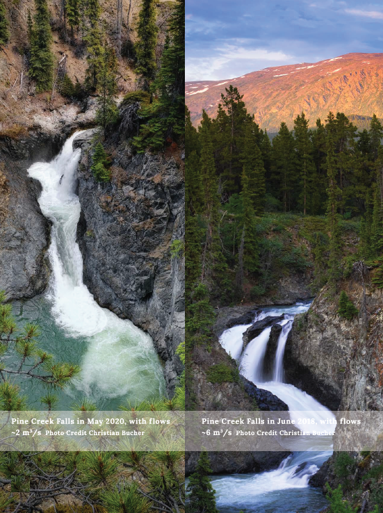
Pine Creek Falls is currently a designated viewpoint located on Surprise Lake Road. This viewpoint coincides with the terminus of the Crocus Trail, making it attractive to tourists and local residents. Flows over the falls currently average 4.0 m3/s, with the lowest flows occurring early May at about 1.0 m3/s. Under the proposed Project, the flow would be reduced in summer to approximately 0.5 m3/s, or half of the lowest flows currently observed over the falls.
Visually, this reduction in flow will change the appearance of the falls. Project engineers estimate that 0.5 m3/s of water will maintain aesthetic flows over the falls, but THEL recognizes that this is subjective.
Factors contributing to the appearance of a waterfall include the height of the fall, steepness of the vertical drop, the flow, the width and the number of cascades. Pine Creek Falls has four main cascades, with the steepest vertical drop being in the first cascade. As such, Pine Creek Falls will likely retain its attractive qualities due to the cascading geometry of the bedrock and canyon, which will continue to funnel water over the falls. In other words, the change in the visual quality of a waterfall is not directly proportional to the volume of water flowing over it.
To illustrate this varied impact of a change in flow, the following images compare the appearance of Pine Creek Falls in May 2020 and June 2018. The difference of flow between these two images is significant, at 3.7 m3/sec, though the resulting change in appearance may seem subtle for some.
Similarly, the images of Shannon Falls and Bridal Veil Falls below demonstrate how even relatively low flows (~1.0 m3/sec) can still have a dramatic appearance. (Shannon Falls, BC, and Bridal Veil Falls, BC, with flows of a maximum of 1.0 m3/s. Source: World Waterfall Database).